The ongoing dispute concerning the potential drilling activities of the Turkish drill ship ‘Fatih’ within the Eastern Mediterranean has triggered Cyprus to deposit with the United National Secretary General a list of geographical coordinates of points concerning the northern and north-western outer limits of the exclusive economic zone and the continental shelf.
The maritime zone notification and geographical points were deposited on the 7 May 2019, as per UNCLOS, article 75(2) and article 84(2). Turkey claims the hydrocarbon exploration is within its rights under international law, while Cyprus, Greece and the EU have condemned any drilling by the vessel ‘Fatih’ as a violation of Cypriot rights. The USA refers to the area as ‘claimed’ by Cyprus and likely to raise tensions, while Egypt also raised concerns.
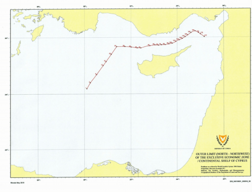
Illustrative Map – Republic of Cyprus Ministry of Foreign Affairs
